
Annapurna Base Camp Trek

Trip Difficulty: Easy

Trip Days:12

Max Elevation: 4430m

Daily Activity: 5-6 hours trek

Trip Starts: Tikhedunga

Trip Ends: Jhinu
The Annapurna Base Camp Trek is a gradual journey from cultivated hillsides to a high glacial basin beneath Annapurna I. The route does not reveal everything at once. It begins among farms, stone villages and damp forest, then narrows beside the Modi Khola before opening into the Annapurna Sanctuary at 4,130 metres. By the final approach, the trees have disappeared and the peaks are no longer distant shapes on the horizon. They form the walls of the valley.
Kudos Expeditions’ 12-day itinerary follows the classic approach through Tikhedhunga, Ghorepani and Poon Hill before turning toward Chhomrong and the sanctuary. It takes longer than the shortest ABC routes, but the additional distance has a purpose. The climb to Poon Hill introduces the body to elevations above 3,000 metres, gives a broad view across the Annapurna and Dhaulagiri ranges and adds the old trading settlements of Ulleri and Ghorepani to the journey.
After Poon Hill, the character of the trek changes. The trail crosses forested ridges to Tadapani, drops toward the Kimrong Khola and climbs to Chhomrong, the last large permanent village on the route. From there, almost every step follows the sanctuary corridor: Sinuwa, Bamboo, Dovan, Deurali, Machhapuchhre Base Camp and finally Annapurna Base Camp.
This is not a technical climb. No ropes, glacier travel or mountaineering experience are required on the standard trail. The challenge comes from repeated stone staircases, long descents followed by fresh climbs, several consecutive walking days and the thinner air above 3,000 metres. A person with sensible preparation and a steady pace can complete the trek, but describing it as effortless would be misleading.
The rewards are equally concrete. You walk through rhododendron and bamboo forest, sleep in locally operated teahouses, pass Gurung and Magar communities and spend a morning inside one of the most enclosed mountain amphitheatres reached by a major trekking trail. Annapurna I rises to 8,091 metres above the sanctuary. Annapurna South, Hiunchuli, Gangapurna, Tent Peak and Machhapuchhre fill the remaining skyline.
The trek begins and ends through Pokhara, which removes the need for a flight into a high mountain airstrip. Road conditions, domestic flight schedules and lodge availability can still change, so every departure requires a degree of flexibility. Your guide manages those moving parts while also monitoring pace, weather and health on the trail.
Annapurna Base Camp Trek at a glance
| Trip detail | Information |
| Destination | Annapurna Base Camp, Nepal |
| Trekking region | Annapurna Conservation Area |
| Highest point | 4,130 m / 13,550 ft |
| Total trip duration | 12 days |
| Typical trekking days | 8–9 days |
| Daily walking | About 5–7 hours; longer on the ABC day |
| Difficulty | Moderate |
| Accommodation | Hotels in cities and teahouses on the trail |
| Main approach | Tikhedhunga – Ghorepani – Poon Hill – Chhomrong – MBC – ABC |
| Main communities | Gurung and Magar |
| Best-known seasons | March–May and September–November |
| Primary permit | Annapurna Conservation Area entry permit |
| Starting gateway | Pokhara |
| Finishing area | Jhinu Danda / lower Modi Khola, then Pokhara |
Why this route earns its place among Nepal’s classic treks
Many trekking pages reduce the Annapurna Base Camp route to a list of peaks. The mountains matter, but the lasting appeal comes from the transition between environments. At lower elevations, the path passes terraces, water buffalo sheds, schoolyards and village courtyards. Higher up, oak and rhododendron close around the trail. Above Deurali, the forest thins quickly and the remaining distance is governed by snow, rock, cloud and the shape of the glacial valley.
The route is also unusually compact. In less than two weeks, a traveller can experience two major viewpoints, several distinct cultural landscapes and an altitude high enough to feel Himalayan without spending long periods above 4,000 metres. That combination makes ABC attractive to first-time visitors who want a serious trek but are not ready for a high pass, as well as experienced walkers who value scenery over altitude records.
Poon Hill and Annapurna Base Camp provide opposite perspectives. From Poon Hill, you look across intervening valleys toward long mountain chains. At base camp, the view is enclosed. Annapurna I dominates the north-western side of the sanctuary, while Machhapuchhre marks the entrance behind you. Including both viewpoints prevents the itinerary from feeling like a rushed out-and-back walk.
Access is another practical advantage. Pokhara has road and air connections with Kathmandu, and the lower trailheads are reached by vehicle. Unlike the Everest region, the trek is not dependent on a flight to Lukla. That does not eliminate delays, but it gives the operator more alternatives when weather or transportation changes.
Trek highlights
- Reach Annapurna Base Camp at 4,130 metres beneath the south face of Annapurna I.
- Watch sunrise over the Annapurna and Dhaulagiri ranges from Poon Hill.
- Walk through Ulleri, Ghorepani, Tadapani, Chhomrong and other established mountain settlements.
- Enter the Annapurna Sanctuary through the narrowing valley above Deurali.
- Visit Machhapuchhre Base Camp before the final approach to ABC.
- See Annapurna South, Hiunchuli, Gangapurna, Tent Peak and Machhapuchhre at close range.
- Follow the Modi Khola through bamboo, oak and rhododendron forest.
- Stay in locally operated teahouses and eat meals prepared along the trail.
- Descend toward Jhinu Danda, with the option to visit the natural hot springs when conditions allow.
- Trek with a local guide who can adjust pace and daily plans to weather, health and lodge conditions.
Who is this trek for?
The route suits active travellers who can walk on uneven ground for several hours and are prepared for simple mountain accommodation. It is often chosen as a first Himalayan trek because the maximum elevation is lower than Everest Base Camp or Thorong La. The lower altitude is helpful, but it does not remove the need for training or sensible acclimatization.
A beginner with a consistent walking routine can do well. A strong gym background without experience on hills is less useful than it may seem, because the route asks for balance, patient pacing and the ability to repeat long ascents and descents on consecutive days. Trekking poles are particularly valuable on the stone staircases below Ghorepani and Chhomrong.
The trip is also suitable for families with older children, mature trekkers and private groups when fitness, health and expectations are assessed honestly. There is no single age limit. A medical consultation is advisable for anyone with cardiovascular, respiratory, joint or other relevant conditions.
Travellers looking for a luxury holiday should understand the limits of the upper sanctuary. Teahouses provide shelter, meals and beds, not resort facilities. Bathrooms may be shared, bedrooms are usually unheated and charging or hot water can cost extra. Accepting those conditions is part of enjoying the trail rather than fighting it.
Understanding the Route
Why include Poon Hill?
The direct route from Pokhara to Chhomrong is shorter, so adding Ghorepani and Poon Hill may seem unnecessary to travellers focused only on reaching base camp. In practice, it changes the trek in useful ways.
First, Poon Hill offers a wide-angle view that cannot be reproduced inside the sanctuary. Dhaulagiri lies west of the Annapurna massif, and both ranges can be seen across the valleys under clear conditions. Second, the ascent to 3,210 metres introduces higher elevation before the route drops toward Chhomrong. It is not a substitute for proper acclimatization, but it gives the body an early exposure to thinner air.
The approach also makes the journey less repetitive. You reach ABC through one sequence of villages and return through another lower route toward Jhinu. Travellers who value variety generally prefer this longer version; those with limited time may choose the direct Ghandruk or Jhinu approach.
The Annapurna Sanctuary
The sanctuary is a high glacial basin enclosed by the central Annapurna peaks. Its entrance is narrow enough that earlier communities regarded the upper valley as a protected, sacred place. The terrain opens only after the trail has passed Deurali and Machhapuchhre Base Camp.
Unlike a viewpoint reached from a road, ABC is approached through several ecological zones. The contrast is part of the experience: humid forest around Bamboo, the rock overhang near Hinku Cave, exposed ground above Deurali and the broad moraine near base camp.
Nepal Tourism Board places Annapurna Base Camp at 4,130 metres and describes it as lying in the heart of the sanctuary. The altitude should be stated consistently across the page, trip facts, itinerary, schema markup and booking system.
Villages and overnight stops that shape the journey
Ulleri
A hillside Magar settlement reached after the first major staircase. It makes the physical character of the lower Annapurna trails clear from the beginning.
Ghorepani
A long-established stop beneath Poon Hill. Its location connects old hill routes and today supports a large concentration of lodges.
Tadapani
A compact forest settlement where gaps in the trees can frame Annapurna South and Machhapuchhre.
Chhomrong
The last substantial permanent village before the sanctuary. Its staircases are demanding in both directions, and nearly every ABC trek passes through it.
Bamboo and Dovan
Small lodge settlements inside the forested Modi Khola corridor. They are functional stops rather than large cultural villages.
Deurali
The point where the landscape becomes more alpine and winter hazard assessment becomes especially important.
Machhapuchhre Base Camp
The final overnight before ABC on this itinerary. It provides a broader setting than the name suggests and places trekkers within the upper sanctuary.
Jhinu Danda
A warm lower stop used on the return. The nearby hot springs are optional and require extra walking.
Difficulty, Altitude and Physical Preparation
How difficult is the Annapurna Base Camp Trek?
The most accurate general rating is moderate. There are no technical climbing sections, yet the route contains enough elevation change and consecutive walking to challenge unprepared travellers.
The lower trail is built around valleys rather than smooth contour lines. You may descend hundreds of metres to a river and regain the same height immediately. Stone steps are common, and wet weather can make them slippery. The ABC day combines the highest point with a long descent, so fatigue management matters after the main objective has been reached.
Daily walking commonly falls between five and seven hours. That figure excludes long meal stops and can increase when road access, lodge availability or weather changes the plan. Pace is more important than speed. A guide who keeps the group slow in the first hour is protecting energy for the afternoon.
Altitude and acute mountain sickness
Altitude sickness can occur above roughly 2,500 metres, and fitness does not provide immunity. Early symptoms may include headache, nausea, dizziness, poor appetite, unusual fatigue and disturbed sleep.
Mild symptoms must be reported rather than hidden. The correct decision may be to rest, stop ascending or descend. Severe breathlessness at rest, confusion, loss of coordination or a persistent wet cough are emergency signs that require immediate action.
This itinerary approaches 4,130 metres gradually and spends limited time at the highest altitude. Poon Hill provides an earlier high point, while the route later drops before climbing through the sanctuary. That profile helps, but it does not guarantee acclimatization.
Drink regularly, eat enough, avoid heavy alcohol consumption and keep a controlled pace. Acetazolamide may be appropriate for some people, but medication decisions belong with a qualified medical professional.
Training plan
Begin structured preparation eight to twelve weeks before departure. People starting from a low activity level should allow more time.
Walking and hills
Complete one longer walk each week on uneven or hilly ground. Build duration gradually and use the boots and daypack intended for Nepal. Stairs, local hills and inclined treadmill sessions are useful when mountain trails are unavailable.
Cardiovascular work
Add two or three sessions of cycling, running, swimming, rowing or brisk walking. The goal is sustained aerobic capacity rather than repeated maximum-intensity efforts.
Strength and descent control
Squats, lunges, step-ups, calf raises, glute bridges and controlled step-downs prepare the legs for stairs. Core work helps maintain posture while carrying a daypack. Downhill control deserves as much attention as climbing strength.
Back-to-back days
During the final month, complete occasional walks on consecutive days. Starting a second day with partly tired legs is more specific preparation than one isolated hard workout.
Taper
Reduce training volume in the final week. Arriving rested is more valuable than completing a last-minute endurance test.
Best Time, Seasons and Weather
Spring: March to May
March begins cool, with possible snow remaining in the sanctuary. Lower trails become increasingly comfortable as the month progresses.
April is popular because rhododendrons often flower in the forest and daytime temperatures are moderate. Afternoon cloud can develop, so mountain views are usually strongest in the morning.
May is warmer and more humid. Pre-monsoon showers and cloud become more likely later in the month, while the lower valleys can feel hot.
Autumn: September to November
September follows the monsoon. The hills are green and waterfalls carry more water, but rain can continue early in the month.
October usually provides the most stable combination of visibility and temperature. It is also crowded, particularly around Poon Hill, Chhomrong and the limited lodges inside the sanctuary.
November brings colder mornings and nights, often with clear air. Late-season snow is possible at higher elevations.
Winter: December to February
Winter offers quieter trails and crisp views during stable weather, but snow and severe cold can affect the upper valley. Avalanche exposure above Deurali requires conservative judgement, and some lodges may reduce services. Winter departures need flexible dates and proper sleeping bags, gloves and traction equipment when advised.
Monsoon: June to August
Rain, cloud, leeches, landslides and slippery steps make the monsoon less predictable. The landscape is intensely green and the trail is quiet, but road disruptions and obscured mountain views are common. Departures should be assessed individually rather than promoted as routine.
What temperatures should you expect?
Conditions vary with elevation, wind, sunlight and recent weather. Lower villages can be warm during the day, while Machhapuchhre Base Camp and ABC can fall below freezing at night. A layered clothing system is essential because a single day may begin cold, become warm during a climb and finish in rain or snow.
Teahouses, Food and Daily Life
Accommodation
Teahouses provide simple twin rooms, mattresses, pillows and blankets. Bedrooms are normally unheated. The dining room may have a stove in the evening, particularly at higher stops.
Bathrooms are often shared. Western and squat toilets both occur. Hot showers, charging and Wi-Fi may be available for a separate fee, but reliability decreases with altitude.
Capacity is restricted in the sanctuary, and private rooms cannot always be guaranteed during busy periods. Travellers may need to share according to lodge allocation. A suitable sleeping bag remains necessary even when blankets are supplied.
Meals
Menus combine Nepalese, Tibetan, Indian and familiar international dishes. Dal bhat—rice, lentil soup, vegetables and pickle—is dependable, filling and widely available. Other common choices include fried rice, noodles, potatoes, soup, pasta, momos, porridge, eggs, chapati and Tibetan bread.
Food is cooked after ordering, so lunch is a genuine rest stop rather than a quick service. At higher elevations, menu variety narrows because supplies are carried into the valley.
Many trekkers choose vegetarian food above Chhomrong because refrigeration is limited. Appetite can decline with altitude, but regular meals remain important. Carbohydrate-rich dishes are generally easier to eat and useful for sustained walking.
Drinking water
Carry reusable bottles and use boiled water, a reliable filter or an appropriate purification treatment. Disposable plastic bottles create avoidable waste and may not be available everywhere. Drink steadily, but do not force excessive water.
Electricity, phone signal and internet
Mobile reception is inconsistent, especially inside the sanctuary. Some lodges sell Wi-Fi and charging, but power can fail during poor weather. A power bank is useful, and batteries should be protected from cold at night.
Permits, Guides, Porters and Insurance
Annapurna Conservation Area permit
The route lies inside the Annapurna Conservation Area, Nepal’s largest protected area. Entry documentation must be arranged before the trek and carried for inspection.
Permit fees and trekking regulations can change. The booking team should confirm the current requirement rather than fixing an old fee permanently in page copy. Special permits apply only to designated restricted areas and are not normally part of the standard ABC route.
Why travel with a guide?
A guide manages more than navigation. The role includes pacing, health observation, lodge coordination, communication with local staff, weather decisions and emergency response.
Above Deurali, local information about snow and avalanche conditions can be more valuable than a generic route description. Guides also help travellers understand village etiquette, religious structures and the names of surrounding peaks.
Porter support
Porters carry the main duffle bags so guests can walk with a lighter daypack. Weight limits should be respected. Responsible packages account for staff wages, food, accommodation, equipment and insurance rather than treating porter welfare as an optional extra.
Travel insurance
Insurance should cover trekking above 4,130 metres, emergency medical treatment, helicopter evacuation and repatriation. Standard policies often exclude high-altitude trekking. Carry the policy number and emergency assistance contact in both printed and digital form.
Packing List
Essential clothing
- Moisture-wicking base layers
- Light trekking shirts and trousers
- Thermal top and bottom
- Fleece or insulated mid-layer
- Down jacket
- Waterproof shell jacket and trousers
- Warm hat, sun hat and neck gaiter
- Light gloves and insulated waterproof gloves
- Trekking socks and dry sleeping clothes
Footwear and equipment
- Broken-in waterproof trekking boots
- Light shoes or sandals for lodges
- Trekking poles
- 25–35 litre daypack with rain cover
- Sleeping bag suitable for sub-zero nights
- Headlamp and spare batteries
- UV-protective sunglasses
- Reusable water bottles and purification method
- Power bank and charging adaptor
- Dry bags or waterproof liners
Health and personal items
- Prescription medication
- Blister care and basic first-aid items
- Sunscreen and lip balm
- Hand sanitiser and biodegradable soap
- Quick-drying towel and wet wipes
- Toilet paper
- Personal hygiene products
- Copies of passport, permits and insurance
- Cash in Nepalese rupees for trail expenses
Pack for function, not for a new outfit every day. Repeating clothing is normal. Excess weight creates unnecessary work for both the trekker and porter.
Safety and Responsible Trekking
Weather and trail decisions
Himalayan weather can change quickly. The guide may delay a start, shorten a stage, remain at a lodge or turn the group around. A published itinerary is a plan, not a guarantee that overrides conditions.
Avalanche awareness
Snow slopes above Deurali have produced serious incidents in the past. Travellers should not attempt to judge the route independently from photographs or older trip reports. Follow current local advice, move efficiently through exposed sections and accept cancellation when risk is too high.
Hygiene and stomach illness
Wash or sanitise hands before eating, use treated water and select freshly cooked food. Carry oral rehydration salts and personal medication recommended by a doctor. Gastrointestinal illness can become more serious when combined with altitude and dehydration.
Environmental conduct
- Carry reusable bottles and reduce single-use packaging.
- Keep batteries and non-biodegradable waste until proper disposal is available.
- Stay on established paths and do not remove plants.
- Do not feed wildlife.
- Use water, fuel and electricity conservatively.
- Ask before photographing local people.
- Walk respectfully around monasteries, chortens and mani walls.
- Avoid loud music on the trail and in villages.
- Do not fly a drone without the required official approval.
Respect for communities
The trail is not an outdoor theme park. It passes homes, farms, religious places and working supply routes. Give way to loaded porters and mule caravans, keep noise low in villages and follow the guide’s advice on dress and photography.
Annapurna Base Camp Compared with Other Treks
| Comparison | Main difference |
| ABC vs Everest Base Camp | Everest Base Camp is longer, higher and more dependent on mountain flights. ABC has more forest and village variation, reaches 4,130 m rather than 5,364 m and places the trekker inside a more enclosed sanctuary. |
| ABC vs Annapurna Circuit | The circuit crosses Thorong La at 5,416 m and travels around the massif. ABC enters the sanctuary beneath Annapurna I. The circuit is generally longer and involves more sustained high-altitude exposure. |
| ABC vs Mardi Himal | Mardi Himal is shorter and follows a ridge facing Machhapuchhre. ABC enters the main sanctuary and usually requires more days, more stairs and a longer high-valley approach. |
| ABC vs Ghorepani Poon Hill | Poon Hill is a shorter lower-altitude trek with panoramic sunrise views. On this itinerary it acts as the opening section before the longer journey to base camp. |
Why Trek with Kudos Expeditions?
A strong trekking package is defined by its decisions when conditions are imperfect. Transportation can be delayed, lodges can fill, weather can close the upper valley and a guest may need a slower pace. The value of an organised trip lies in handling those variables without turning them into the client’s daily problem.
Kudos Expeditions arranges airport transfers, the Pokhara connection, trekking permits, teahouse accommodation, meals according to the package and the local guide-and-porter team. Before departure, the team checks equipment and explains what the upper lodges can realistically provide.
On the trail, the guide sets the pace, monitors symptoms, confirms accommodation and responds to current conditions. The objective is not to force every group through an identical timetable. It is to complete the route responsibly while giving travellers enough time to see and understand the places they have walked through.
Exact inclusions, departure dates, group size and price should remain visible in the booking module and confirmed invoice. This avoids contradictions when a flight, hotel category or seasonal service changes.
Frequently Asked Questions
How difficult is the Annapurna Base Camp (ABC) Trek?
ABC is a moderate trek that does not require extreme high-altitude acclimatization like EBC. The highest point is Base Camp at 4,130m. It involves many steep stone staircases, so strong leg muscles and cardiovascular fitness are highly recommended.
How long does the ABC Trek take?
Our standard itinerary takes 10 days and 9 nights. This allows for a comfortable pace through the lush rhododendron forests and traditional Gurung villages before reaching the spectacular Annapurna Sanctuary.
Is there a risk of avalanches on the ABC Trek?
Yes, the section between Deurali and Machhapuchhre Base Camp is a known avalanche zone, particularly after heavy snowfall in late winter or early spring. Ang Tsering Sherpa’s extensive mountain experience ensures we cross these areas safely or adjust plans based on local conditions.
What is the accommodation like on the ABC Trek?
The trail features well-established teahouses. However, as you get closer to Base Camp, the number of lodges decreases and rooms are often shared. Ang secures accommodations in advance, ensuring you have a warm bed after a long day of hiking.
Can beginners do the Annapurna Base Camp Trek?
Absolutely. ABC is often recommended as an ideal first Himalayan trek. The lower maximum altitude reduces the risk of AMS, and Ang’s personalized guiding ensures the pace matches your comfort level.
Book the Annapurna Base Camp Trek
The route to Annapurna Base Camp works because the destination is earned gradually. The trail begins among farms and villages, climbs into forest and follows the Modi Khola until the valley opens beneath Annapurna I. Poon Hill provides the wider view; the sanctuary supplies the scale.
Contact Kudos Expeditions to discuss available departure dates, private groups, equipment, current trail conditions and the most appropriate season for your travel plans.
Standard Annapurna Base Camp Trek Itinerary
Day 1
Arrival in Kathmandu
Your journey begins when you arrive at Tribhuvan International Airport in Kathmandu. A representative from Kudos Expeditions will meet you outside the arrival terminal and transfer you to your hotel. Kathmandu is Nepal’s political and cultural capital, but for most trekkers the first day is primarily about recovery. International flights can be tiring, and traffic between the airport and the hotel may take longer than expected. After checking in, you can rest or explore the area near your hotel. Depending on your arrival time, the trek leader may conduct an initial meeting to explain the schedule and confirm arrangements for the following day. Keep your passport, travel insurance details and emergency contact information available. Any missing trekking equipment can usually be purchased or rented in Kathmandu before departure. Accommodation: Hotel in Kathmandu Altitude: Approximately 1,400 metres Activity: Airport arrival and transferDay 2
Flight to Pokhara and trek preparation
After breakfast, you transfer to the domestic airport for the flight to Pokhara. The flight is short, and in clear weather the northern side of the aircraft may offer views of Nepal’s central Himalayan ranges. Pokhara sits beside Phewa Lake beneath the Annapurna massif. It is the principal gateway for treks in the Annapurna region and has a wide range of hotels, trekking shops, restaurants and transport services. After arriving, the team completes a final equipment inspection. Your guide checks footwear, waterproof layers, warm clothing, sleeping bag, trekking poles and personal medication. Your main trekking luggage is packed in the company duffle bag for the porter, while items needed during the day remain in your personal backpack. The remainder of the day can be used to rest or walk around the lakeside area. An early night is recommended because the road and trekking journey begins the next morning. Domestic flights in Nepal are weather-dependent. When a flight is delayed or cancelled, the itinerary may be adjusted or road transport may be used. Accommodation: Hotel in Pokhara Altitude: Approximately 820 metres Meals: Breakfast Activity: Domestic flight and trek briefingDay 3
Drive from Pokhara to Tikhedhunga and trek to Ulleri
The team leaves Pokhara after breakfast and drives into the lower Annapurna foothills. The exact vehicle route depends on current road conditions and the selected trailhead. The journey passes through settlements, farmland and river valleys before reaching the starting area near Tikhedhunga. Porters organise the luggage, and the walking portion of the trip begins. The trail crosses small bridges and follows a mixture of village paths, stone steps and unpaved track. The main challenge is the climb toward Ulleri, which is known for its long staircase. There are more than enough steps to make the first day memorable. The key is not to attack the climb. A steady rhythm allows your breathing and leg muscles to adapt to the work that will be repeated throughout the trek. Ulleri is a Magar village built on a steep hillside. When the weather is clear, the upper parts of the village offer the first close views toward Annapurna South and Hiunchuli. Accommodation: Teahouse in Ulleri Altitude: Approximately 2,050 metres Walking time: Approximately 4–5 hours Meals: Breakfast, lunch and dinnerDay 4
Trek from Ulleri to Ghorepani
The trail continues uphill from Ulleri and gradually enters a cooler forest environment. After passing Banthanti, the route follows streams and climbs through oak and rhododendron woodland. The forest provides shade, although the stone steps and sustained ascent make this a physically active day. Small teahouses along the route provide opportunities to stop for tea, water or lunch. In spring, the rhododendron trees may be covered with red, pink or white flowers. During autumn, the air is often clearer and the forest floor drier. Ghorepani is one of the busiest trekking settlements in the lower Annapurna region. Its position below Poon Hill makes it an important overnight stop for sunrise trekkers. The name Ghorepani is commonly associated with the historical practice of traders stopping here to water their horses. Today, the village has numerous lodges, bakeries and mountain viewpoints. After reaching the lodge, prepare warm clothing and a headlamp for the early morning walk to Poon Hill. Accommodation: Teahouse in Ghorepani Altitude: Approximately 2,860 metres Walking time: Approximately 5–6 hours Meals: Breakfast, lunch and dinnerDay 5
Sunrise at Poon Hill and trek to Tadapani
You wake before dawn and begin the climb to Poon Hill with a headlamp. The stone trail rises above Ghorepani through forest before reaching the open viewpoint at approximately 3,210 metres. The temperature can be cold while you wait for sunrise, so carry a down jacket, gloves and warm hat. Hot drinks may be available near the viewpoint during the main trekking seasons. As daylight arrives, the Dhaulagiri and Annapurna ranges become visible across the valleys. Dhaulagiri I, Tukuche Peak, Nilgiri, Annapurna I, Annapurna South, Hiunchuli and Machhapuchhre may all be seen when the weather is clear. After taking photographs and watching the changing light, you descend to Ghorepani for breakfast. The main trek then continues toward Tadapani. The route climbs to a forested ridge before descending and ascending through a series of small valleys. This stage can feel longer than expected because of the repeated elevation changes after the early Poon Hill walk. Tadapani is a compact settlement surrounded by forest. On a clear morning or evening, it offers close views of Annapurna South and Machhapuchhre. Accommodation: Teahouse in Tadapani Altitude: Approximately 2,630 metres Walking time: Approximately 6–7 hours, including Poon Hill Meals: Breakfast, lunch and dinnerDay 6
Trek from Tadapani to Chhomrong
The trail descends through forest and cultivated slopes toward the Kimrong Khola. After crossing the river, a sustained climb leads toward Gurjung and the higher villages. The surroundings become more open as you approach Chhomrong. Terraced fields spread across the hillside, with Annapurna South rising above the head of the valley. Chhomrong is the largest permanent village on the direct approach to the Annapurna Sanctuary. Its stone stairways extend down the hillside, and lodges are positioned at several levels of the settlement. The view of Machhapuchhre from Chhomrong is especially distinctive. The mountain’s twin summit resembles a fishtail from certain angles, giving rise to its English name, Fishtail Mountain. Machhapuchhre is considered sacred, and climbing to its summit is not permitted. Its elegant shape remains a constant visual marker during much of the trek. The evening in Chhomrong is a good time to reorganise your pack. From the next day onward, the valley narrows and the facilities become progressively more basic. Accommodation: Teahouse in Chhomrong Altitude: Approximately 2,170 metres Walking time: Approximately 5–6 hours Meals: Breakfast, lunch and dinnerDay 7
Trek from Chhomrong to Dovan
The day begins with a long descent down Chhomrong’s stone staircase to the Chhomrong Khola. After crossing the suspension bridge, the trail climbs steeply to Sinuwa. This early descent and ascent can be mentally demanding because it seems to lose hard-earned elevation. It is a typical feature of Himalayan trekking: the shape of the valley matters more than the straight-line distance. Beyond Sinuwa, the route enters dense forest and passes through Khuldighar. Long sections are shaded by bamboo, oak and rhododendron. The trail then descends toward Bamboo, a small lodge settlement named after the surrounding vegetation. From Bamboo, you continue upward through the gorge toward Dovan. The Modi Khola flows below the trail, fed by glaciers and streams descending from the sanctuary. Waterfalls appear across the valley, particularly after rain or during warmer periods when snow is melting. Dovan is a small overnight settlement rather than a traditional agricultural village. The lodges are simple, and the forested valley receives limited direct sunlight. Accommodation: Teahouse in Dovan Altitude: Approximately 2,500–2,600 metres Walking time: Approximately 6–7 hours Meals: Breakfast, lunch and dinnerDay 8
Trek from Dovan to Machhapuchhre Base Camp
Today you leave the dense lower gorge and move into the high alpine environment. The trail climbs through forest toward Himalaya and continues to Hinku Cave, a large overhanging rock formation historically used as shelter. From here, the landscape becomes steeper and more exposed. The route proceeds toward Deurali, where the vegetation begins to thin. Beyond the settlement, you enter a section that can be affected by snow and avalanche conditions during winter or periods of heavy accumulation. Your guide will assess the current trail and choose the appropriate line. Instructions must be followed closely in exposed areas, and unnecessary stopping should be avoided where there is a known hazard. The valley narrows between Hiunchuli and Machhapuchhre before opening near Machhapuchhre Base Camp. Although the location is called a base camp, expeditions do not normally climb Machhapuchhre because of its protected sacred status. The views change dramatically here. Machhapuchhre rises behind the lodge area, while Annapurna South, Hiunchuli, Gangapurna and other peaks begin to surround the upper valley. Sleeping above 3,700 metres may affect appetite and sleep quality. Drink water, eat a full meal and inform your guide about any headache, nausea, dizziness or unusual fatigue. Accommodation: Teahouse at Machhapuchhre Base Camp Altitude: Approximately 3,700 metres Walking time: Approximately 6–7 hours Meals: Breakfast, lunch and dinnerDay 9
Trek to Annapurna Base Camp and descend to Bamboo
The team starts early for the final approach to Annapurna Base Camp. The trail climbs gradually through the broad upper sanctuary. There are no major technical sections, but the altitude makes the pace slower. Frost or snow may cover parts of the path during colder months. As you walk, the south face of Annapurna I becomes increasingly dominant. The mountain rises approximately four vertical kilometres above the base camp area, creating one of the most dramatic reliefs encountered on a popular trekking route. Annapurna Base Camp stands at approximately 4,130 metres. Prayer flags, memorials and lodge buildings occupy the moraine beside the glacier. The surrounding panorama may include Annapurna I, Annapurna South, Hiunchuli, Tent Peak, Singu Chuli, Gangapurna, Annapurna III and Machhapuchhre. Time at base camp depends on weather, group condition and the day’s descent plan. The team normally pauses for photographs, a warm drink and a proper look around the sanctuary. The journey then turns downhill. You retrace the route past Machhapuchhre Base Camp and Deurali before continuing into the forest. Descending to Bamboo is a long day, but sleeping at a lower altitude usually improves appetite and rest. The thicker air and warmer temperature become noticeable as you leave the sanctuary. Accommodation: Teahouse in Bamboo Highest altitude: 4,130 metres Walking time: Approximately 7–9 hours Meals: Breakfast, lunch and dinnerDay 10
Trek from Bamboo to Jhinu Danda
The route climbs from Bamboo to Sinuwa before descending to the Chhomrong Khola. You then face the familiar staircase back into Chhomrong. After a rest or lunch in the village, the trail leaves the main sanctuary approach and descends toward Jhinu Danda. Jhinu sits on a warm, forested hillside above the Modi Khola. The change in climate is considerable compared with the previous morning at Annapurna Base Camp. When time and conditions permit, you can walk down to the natural hot springs beside the river. The path is steep, and you must climb back afterward, so take only the items you need. Soaking in the warm water can feel restorative after the long descent from the sanctuary. The riverside setting also provides a quieter final evening before returning to Pokhara. Accommodation: Teahouse in Jhinu Danda Altitude: Approximately 1,780 metres Walking time: Approximately 5–6 hours, excluding hot springs Meals: Breakfast, lunch and dinnerDay 11
Trek from Jhinu Danda and drive to Pokhara
After breakfast, you complete the final section of the trek. The exact walking endpoint and vehicle pickup location may vary as roads and bridge access change in the lower valley. The route crosses the Modi Khola and follows village trails or jeep tracks toward the road connection. Porters and trekking staff complete their duties at the agreed endpoint before the group travels back to Pokhara. The drive returns through the middle hills and cultivated valleys. Reaching the city brings paved roads, private bathrooms and a wider choice of food, all of which may feel unusually luxurious after the teahouses. After checking into the hotel, the remainder of the day is free. You may rest, enjoy a meal beside Phewa Lake or walk through the lakeside area. Accommodation: Hotel in Pokhara Walking time: Approximately 2–4 hours Driving time: Approximately 2–4 hours, subject to road conditions Meals: Breakfast and lunch, depending on package arrangementsDay 12
Fly from Pokhara to Kathmandu and departure arrangements
After breakfast, you transfer to Pokhara Airport for the flight back to Kathmandu. On a clear day, the flight may provide another view of the Himalayan ranges you have just visited. After arriving in Kathmandu, you are transferred according to the onward schedule. Travellers with a later international departure may continue directly to Tribhuvan International Airport. Those staying an additional night can be transferred to their hotel. Domestic flights remain subject to weather and operational conditions. It is sensible to keep adequate time between the Pokhara flight and an international departure rather than relying on a tight same-day connection. Meals: Breakfast Activity: Domestic flight and transferThings Included in Trip cost

Transportation
-
Airport pick-up in Kathmandu by private vehicle
-
Airport drop-off in Kathmandu by private vehicle
-
Domestic flight from Kathmandu to Pokhara
-
Domestic flight from Pokhara to Kathmandu

Accommodation
- Teahouse accommodation during the entire trek

Meals
-
Daily tea, breakfast, lunch, and dinner during trekking days
-
Afternoon tea and biscuits at around 4:00 PM after reaching the teahouse/camp
-
Seasonal fresh fruits after dinner during the trek
- Farewell dinner in Kathmandu on the last evening

Human Resource
-
Experienced English-speaking guide personally guided by ANG
-
Assistant Sherpa guide (1 assistant for every 5 trekkers)
-
Porters as required (typically 1 porter for every 2 trekkers)
-
All staff wages, meals, accommodation, and insurance for Nepali crew

Documentations
-
Annapurna Conservation Permit
-
TIMS (Trekkers’ Information Management System) card
- NTNC
- All government taxes and local service taxes

Trek Support Gears
- Company-provided trekking duffle bag
Things Not Included in Trip cost

Visa & Travel Documents
Nepal visa fee (please bring two passport-size photos and cash in USD denomination)

International Travel
-
International airfare to and from Nepal
-
Excess baggage charges for domestic flights

Personal Insurance (Mandatory)
-
Personal travel insurance
-
High-altitude rescue and helicopter evacuation insurance
Meals in Kathmandu
-
Lunch and dinner in Kathmandu (except farewell dinner)
-
Meals in Kathmandu if you return early from the trek
Extra Hotel Nights in Kathmandu
-
Extra nights in Kathmandu due to early arrival, late departure, or early return from the trek for any reason
-
Extra nights caused by flight delays or itinerary changes outside the scheduled program

Personal Expenses
-
Extended activities and extra destinations not mentioned in the itinerary
-
Cold drinks during the trek (mineral water, soft drinks, beer, bar bills, bakery items, machine coffee)
-
Hot showers during the trek
-
Battery charging fees for electronic devices
-
Wi-Fi/internet charges during the trek

Tips and Gratitude
- Tips for guides, assistant guides, and porters

Emergency Cost
- Helicopter evacuation in case of emergency (covered by your insurance, not by the package)
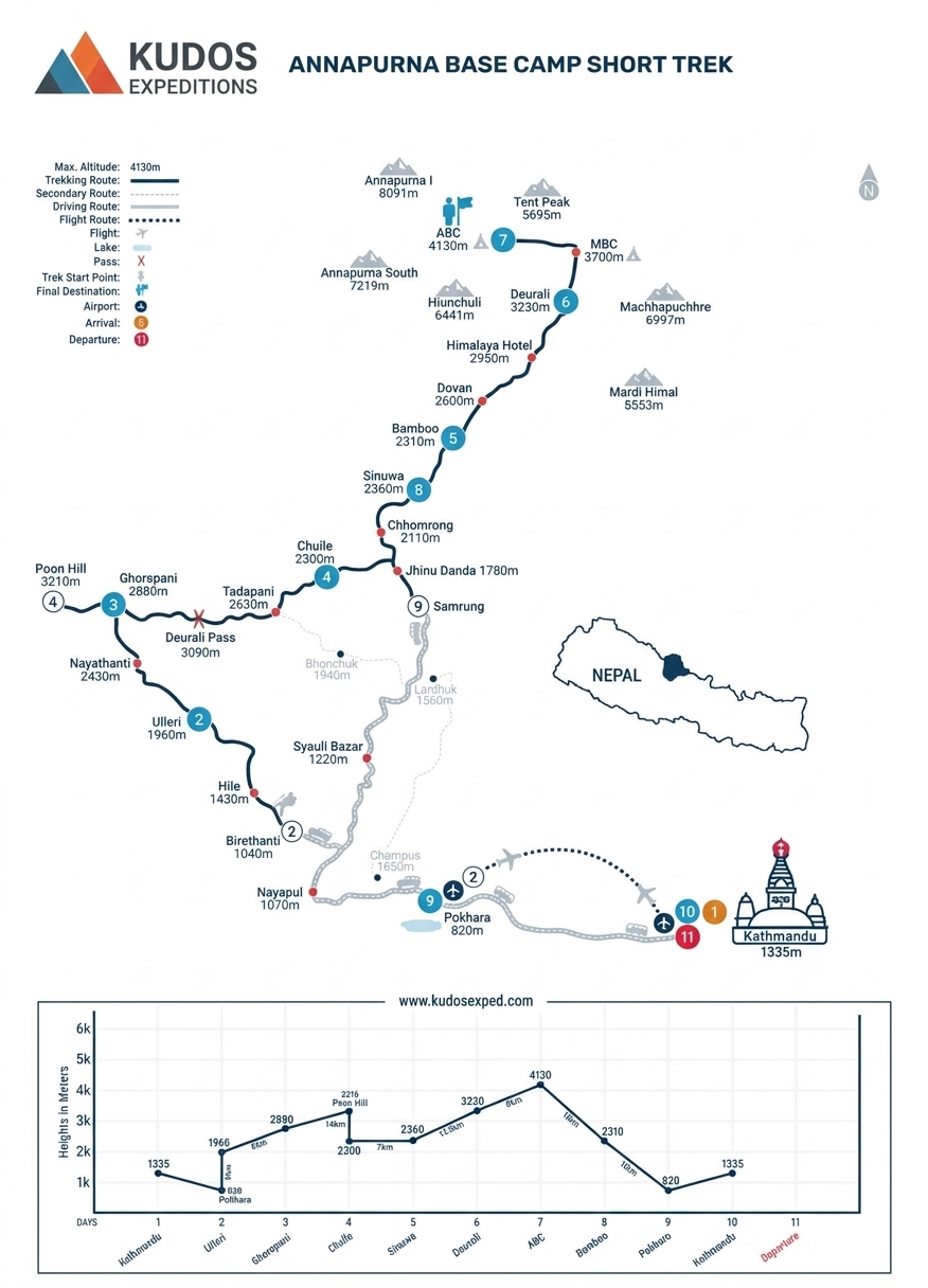
Annapurna Base Camp Trek Trek MAP
Book Now
Join fixed Departure with Ang
Departing Dates
and Price
Availability
1 March, 2026 - 10 March, 2026
$ 1450
1
9 June, 2026 - 21 June, 2026
$ 1450
1
Must Know Before your Trip
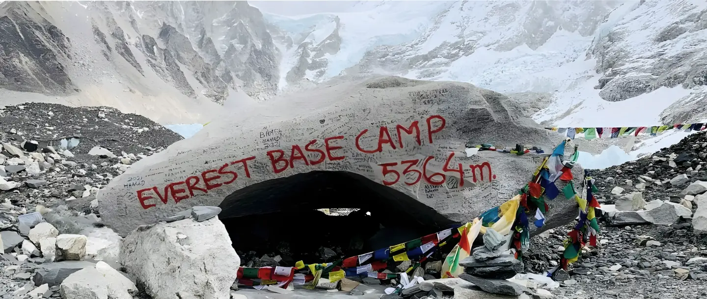
Everest Base Camp Trek: The Complete 2026 Planning Guide

Why Every High-Altitude Trekker Needs These Two Life-Saving Tools (And How to Use Them Properly)

Acclimatiation Process to make your trip successful
