
Manaslu Circuit Trek

Trip Difficulty: Moderate

Trip Days:15

Max Elevation: 5,106 m/16,752 ft)

Daily Activity: 5-6 hours Trek

Trip Starts: Machha Khola

Trip Ends: Dharapani
Quick Facts
| Duration | 15 days (Kathmandu to Kathmandu) |
| Trek days | 10 days of walking, plus 1 acclimatization day |
| Max altitude | Larkya La Pass, roughly 5,106m / 16,752ft |
| Difficulty | Moderate to challenging |
| Trip starts | Machha Khola |
| Trip ends | Dharapani |
| Group size | Minimum 2 trekkers (restricted area rule) |
| Accommodation | 3-star hotel in Kathmandu, teahouses on the trail |
| Best seasons | March–May and September–November |
| Guide | Personally led by Ang Sherpa |
Machha Khola to Dharapani, on foot, around the eighth-highest mountain on earth.
There’s a particular kind of quiet you find on the Manaslu Circuit that’s harder to come by on Nepal’s more famous trails these days. You can walk for an hour along the Budhi Gandaki gorge and pass nobody but a mule train or a farmer carrying fodder on his back. That’s not an accident of geography. It’s policy. Manaslu sits inside a restricted area, which means every trekker needs a special permit and a licensed guide, and the government caps how freely people can move through it. The upside of all that paperwork is a trail that still feels the way Everest and Annapurna probably felt thirty years ago.
The trek runs in a rough arc around Mount Manaslu (8,163m), starting low in the subtropical hills of Gorkha district and climbing steadily north along the Budhi Gandaki River before turning west over the Larkya La Pass and dropping into the Marsyangdi valley, where it joins the tail end of the Annapurna Circuit. Along the way you pass through Gurung farming villages, then Tibetan-influenced settlements like Lho, Sama Gaun, and Samdo, where the architecture, the language on the mani stones, and the food on your plate all start to shift. It’s one trek, but it feels like three or four different countries stitched together.
With Kudos Expeditions, the full trip runs 15 days door to door, Kathmandu to Kathmandu, and is personally guided by Ang Sherpa. Below is everything we think you should know before you sign up: the route, the permits, the pass, the food, the packing list, and the day-by-day breakdown.
Why People Choose Manaslu Over Everest or Annapurna
We get asked this a lot, usually by trekkers who’ve already done Everest Base Camp or the Annapurna Circuit and want something less crowded for their second trip to Nepal. Here’s the honest comparison.
Everest Base Camp gets somewhere around 40,000-plus trekkers a year now. In peak season, the teahouses in Namche and Dingboche fill up early, and you’ll share the trail with a steady stream of other walkers most of the day. Manaslu, by contrast, sees a fraction of that traffic, largely because it’s a restricted area with permit costs and guide requirements that filter out casual or last-minute travelers. That paperwork is annoying if you’re used to just showing up and walking. It’s also exactly why the trail has stayed this quiet.
The landscape does something Everest and Annapurna don’t manage quite as well: it changes completely as you go. You start in rice terraces and banana trees at under 1,000 meters, walk through bamboo and rhododendron forest, cross into pine and juniper at Namrung, and by the time you reach Sama Gaun you’re in high-altitude Tibetan Buddhist territory with yak pastures and stone gompas. Then you cross a genuinely difficult 5,000-meter-plus pass and drop into the lush Marsyangdi valley on the other side. Few treks in Nepal compress that much variety into two weeks.
It’s not an easier trek, to be clear. If anything, the days are longer and the trail rougher in sections than what you’d find on Everest Base Camp. But if solitude and a working sense of adventure matter more to you than well-stocked bakeries and wifi in every lodge, Manaslu delivers something the busier routes can’t anymore.
The Trail: What You’re Actually Walking Through
The first three or four days follow the Budhi Gandaki River upstream through Gorkha district, a part of Nepal most visitors never see since there’s no other reason for a foreigner to be there. This section is subtropical: warm, humid in the shoulder seasons, thick with terraced rice and millet fields, and dotted with Gurung and Ghale villages where farming and small-scale tourism now run side by side. You’ll cross a lot of suspension bridges here, some of them fairly high above the river, and pass through narrow gorge sections where the trail has been cut directly into the cliff face.
Around Namrung, the character of the trail starts to change. The valley widens, the air cools, and you begin to see the first real Tibetan-Buddhist influence: mani walls (stone walls carved with Buddhist prayers, which you should always pass on your left), chortens, and small monasteries. By Lho and Shyala, Manaslu itself is visible above the treeline most of the day, and it stays in view more or less continuously from there until you cross the pass.
Sama Gaun is the largest settlement on the upper trail and functions as the region’s unofficial capital. It has a health post, a small airstrip used mostly by mountaineering expeditions, and enough guesthouses that it doesn’t feel quite as remote as it is. From here the trail climbs into genuinely high, dry, wind-scoured terrain: yak pastures, glacial moraine, and villages like Samdo that sit close enough to the Tibetan border that trade with Chinese-administered Tibet still shapes daily life.
The last push, from Dharmasala over Larkya La and down to Bimthang, is where the trek earns its “challenging” rating. It’s a long day at altitude, on a trail that’s rocky and sometimes icy near the top, followed by a steep, occasionally slippery descent. Past the pass, the scenery flips again. You drop into a lush, glacier-fed valley below Manaslu’s western flank, and by Dharapani you’re back among terraced fields, water buffalo, and the more developed infrastructure of the Annapurna Circuit trail.
Mount Manaslu and the Larkya La Pass
Manaslu means “mountain of the spirit,” from the Sanskrit manasa. At 8,163 meters it’s the eighth-highest mountain in the world, and unlike Everest, you get to walk right up close to it: the trek passes within a few kilometers of its base on the Sama Gaun side. Climbers use the same approach route for their expeditions, so in autumn, when summit attempts are underway, you’ll likely cross paths with mountaineering teams and their support staff around Sama Gaun.
The Larkya La Pass is the trek’s centerpiece and its biggest physical test. Elevation figures vary a bit depending on the source and the exact GPS reading. Most official Nepali trekking literature lists it at 5,106m (16,752ft), though some guidebooks and GPS units clock it closer to 5,160m. Either way, it’s one of the higher trekking passes in Nepal that doesn’t require technical climbing gear.
Crossing it is a full day. You’ll typically leave Dharmasala well before sunrise, often around 3 to 4am, both to beat the winds that tend to pick up by late morning and to give yourself enough daylight for the long descent on the other side. The final approach to the pass is a steady, grinding climb over loose rock and, depending on the season, packed snow or ice. At the top, on a clear morning, you get a 360-degree view that includes Manaslu itself, Himlung Himal, Cheo Himal, Kang Guru, and Annapurna II in the distance. It’s a genuinely difficult few hours of walking, and also the reason most people remember this trek so vividly.
The descent to Bimthang is steep and can be slippery, particularly if there’s fresh snow, so trekking poles and proper boots matter here more than almost anywhere else on the trip.
The People and the Culture Along the Way
The lower Budhi Gandaki valley is Gurung and Ghale country, communities with roots in Nepal’s hill farming traditions. Many of the men from these villages have historically served in the Gurkha regiments of the British and Indian armies. Villages like Jagat and Philim have a settled, agricultural feel, with stone-paved lanes and terraced fields cut into steep hillsides.
Higher up, past Namrung, you’re walking through what locals call Nubri, a region with strong Tibetan Buddhist roots. The people here, along with the Tsumba people of the neighboring Tsum Valley, trace much of their language, religious practice, and architecture back to Tibet, and many families still maintain trade and family ties across the border. You’ll see this in the mani walls that line the trail, the chortens marking village entrances, and monasteries like Pungyen Gompa near Sama Gaun, one of the most important religious sites in the region.
A few things worth knowing before you go, so you’re not fumbling with etiquette on the trail: pass mani walls and chortens on your left, spin prayer wheels clockwise, ask before photographing people or the inside of a monastery, and remove your shoes before entering a home or gompa. None of this is complicated, but it’s noticed and appreciated when visitors get it right.
Teahouse owners along this route are, almost without exception, warm and easy to talk to, and a fair number speak enough English to have a real conversation about the harvest, the weather, or how business has changed since tourism picked up. Evenings in the dining room, gathered around whatever’s heating the room (usually a wood or dung-burning stove), tend to be one of the better parts of the trip, as much for the conversation as the food.
Best Time to Trek the Manaslu Circuit
Autumn (late September through November) is generally considered the strongest window. The monsoon has cleared out by then, skies are usually stable, and you get the best odds of clear views from Larkya La. Daytime temperatures on the lower trail run comfortably mild, dropping toward freezing and below once you’re above 4,000 meters, especially at night. This is also peak season for Manaslu summit expeditions, so Sama Gaun has a bit more energy and activity than usual.
Spring (March through May) is the other reliable option, and arguably more scenic in the lower valleys. Rhododendron forests bloom in shades of red, pink, and white through March and April, and the trail generally sees fewer trekkers than autumn. Weather is a bit less predictable toward late May as pre-monsoon clouds start building in the afternoons, but mornings are usually clear.
Winter (December through February) is workable if you don’t mind cold and are flexible about the pass. Above 4,000 meters, temperatures regularly drop below -15°C at night, and heavy snowfall can close Larkya La for days at a time. Some operators won’t run winter departures at all for exactly this reason. If it does work out, you’ll likely have the trail almost entirely to yourself.
Monsoon (June through August) is the season we’d steer most people away from. Trails turn to mud, leeches show up in the lower forested sections, and the Budhi Gandaki valley is genuinely prone to landslides in heavy rain. This isn’t a minor inconvenience; it’s a real safety consideration given how the trail is cut into steep hillsides in places. Cloud cover also means you’ll likely miss most of the mountain views the trek is known for. If you’re set on a monsoon trek for some reason, talk to us first.
Permits and Regulations (and Why They Exist)
Manaslu is one of a handful of regions in Nepal still classified as a restricted area, which means the permit process is more involved than on open trails like Everest Base Camp. You’ll need:
- Manaslu Restricted Area Permit (RAP): issued through the Department of Immigration, and only available through a registered trekking agency (you can’t apply for this one yourself). Costs vary by season: expect somewhere around $100 for the first week during September–November, and roughly $75 for a week in other months, with a daily surcharge for extra days beyond the first seven. These figures move periodically, so we always confirm current rates when we file your paperwork.
- Manaslu Conservation Area Permit (MCAP): around NPR 3,000 for foreign nationals, covering the conservation area the trail passes through on its way up the valley.
- Annapurna Conservation Area Permit (ACAP): also around NPR 3,000, required because the trail exits through Annapurna Conservation Area territory near Dharapani.
- Tsum-Nubri Rural Municipality entry fee: a smaller local charge, usually NPR 1,000–2,000, collected at the Jagat checkpoint.
Kudos Expeditions handles all of this for you as part of the trip. It’s what Day 2 of the itinerary (a full prep day in Kathmandu) is mostly for. We’ll need your original passport and passport photos in advance to get the paperwork filed correctly, since restricted area permits can’t be rushed at the last minute the way a standard TIMS card can.
The other regulation worth knowing: you need a licensed guide, no exceptions, and historically the rule has required a minimum group size of two trekkers. Enforcement of the group-size rule has shifted somewhat over the years, so if you’re traveling solo, tell us early. We can usually match you with another traveler on a fixed departure, or confirm the current requirement before you commit to dates.
These rules add cost and a bit of bureaucracy, no question. What they buy you is a trail that hasn’t been reshaped by mass tourism the way some of Nepal’s other classic routes have.
How Hard Is the Manaslu Circuit, Really?
We rate this trek moderate to challenging, and we mean that specifically, not as a hedge. The daily walking is comparable to Everest Base Camp or the Annapurna Circuit: five to eight hours most days, with a few shorter days built in around Sama Gaun and Samdo for acclimatization. What sets Manaslu apart is the Larkya La crossing itself: a 10-hour day starting before dawn, at altitude, over rough and sometimes icy terrain, followed by a knee-jarring descent. That single day is genuinely tough, even for trekkers who’ve done EBC without much trouble.
You don’t need technical mountaineering skills. No ropes, no crampons for glacier travel, no prior climbing experience. What you do need is solid cardiovascular fitness and, ideally, some prior experience with multi-day trekking at altitude. If your longest hike to date has been a weekend day trip, we’d suggest building up your base fitness for two to three months before you come. Regular hiking with a loaded pack, plus some running, cycling, or stair training, goes a long way.
Altitude is the bigger variable than raw fitness, honestly. Some very fit trekkers struggle with acclimatization while less athletic ones sail through, and there’s no reliable way to predict which category you’ll fall into until you’re actually up there. The itinerary builds in one dedicated acclimatization day at Samdo before you push on to Dharmasala and the pass, and the daily altitude gains are kept reasonable by design. Still, take it seriously: tell your guide immediately if you’re getting headaches, nausea, or unusual fatigue, and don’t push through symptoms hoping they’ll pass on their own.
Accommodation and Food on the Trail
This is a teahouse trek from start to finish — no camping required. Rooms are simple: twin beds, a mattress, a pillow, and usually thin walls, especially at higher elevations where construction materials are harder to bring in. Bathrooms are shared in most places, sometimes attached to the lodge, sometimes a short walk outside, and squat-style toilets are more common than Western ones the higher you go. Bring a sleeping bag rated for at least -10°C to -15°C, since heating is generally limited to the communal dining room, not the bedrooms.
Food follows the same pattern you’ll find on most Nepal treks: a menu built around dal bhat (rice, lentil soup, and vegetable curry, usually with a free second helping), plus noodle soups, momos, fried rice, pancakes, and basic pasta dishes. Dal bhat is worth defaulting to more often than not: it’s freshly cooked, it’s filling, and the unlimited refills make it good fuel for long trekking days. Menus get shorter and prices climb a bit the higher you go, simply because everything has to be carried in on someone’s back or a mule’s.
Drinking water is available at every teahouse, either boiled (ask for it; it’s usually cheap) or as bottled water (pricier, and we’d rather you avoid the plastic waste if you can). Bring a bottle you can refill and a supply of purification tablets or a filter as backup.
What’s Included and What Isn’t
The trip price covers your airport transfers, three nights in a 3-star Kathmandu hotel on a bed-and-breakfast basis, teahouse accommodation for the entire trek, all meals while trekking (breakfast, lunch, and dinner, plus tea), your guide (personally led by Ang), an assistant guide, porters, all the permits mentioned above, staff insurance, and a trekking duffel bag.
Not included: your Nepal visa fee, international flights, personal travel and high-altitude rescue insurance (this one’s non-negotiable; get a policy that explicitly covers helicopter evacuation above 5,000m before you arrive), lunch and dinner in Kathmandu outside of the farewell meal, any extra hotel nights caused by flight changes or an early return from the trek, and personal expenses on the trail: hot showers, device charging, wifi, bottled or bar drinks, and snacks. Tips for your guide, assistant guide, and porters aren’t included either, though they’re customary and genuinely appreciated; budget roughly 10% of your trip cost if you’re unsure how much to set aside.
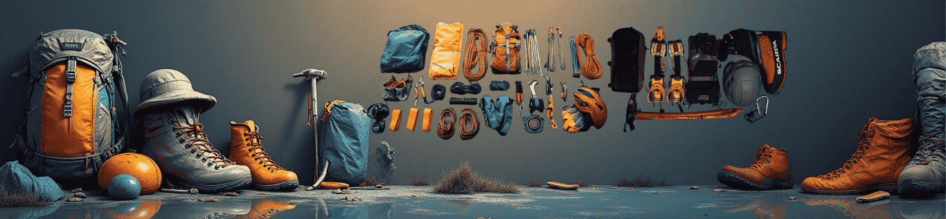
What to Pack
You don’t need to over-buy for this trek, but a few things matter more here than on gentler routes because of the altitude and the basic teahouse facilities above 3,500m.
- Layering system: moisture-wicking base layers, a fleece or light insulating layer, and a proper down jacket for the upper trail and pass day
- Sleeping bag: rated to at least -15°C (bedroom heating is essentially nonexistent above Namrung)
- Footwear: broken-in, waterproof trekking boots, plus a lightweight pair of camp shoes for evenings
- Trekking poles: genuinely useful on the descent from Larkya La, where the trail is loose and sometimes icy
- Headlamp: you’ll be walking before sunrise at least once, on pass day
- Water purification: tablets or a filter, as backup to boiled water from teahouses
- Sun protection: high-SPF sunscreen, lip balm, sunglasses rated for high-altitude glare
- Cash: Nepali rupees, since there are no ATMs on the trail and teahouses don’t take cards. Bring more than you think you’ll need for showers, charging, and snacks
- First-aid basics: any personal medication, blister treatment, altitude medication if prescribed by your doctor, and a basic kit for cuts and scrapes
We provide a duffel bag as part of the trip, and can arrange rental gear in Kathmandu for anything you’d rather not fly with, down jackets and sleeping bags especially.
Safety and Altitude Sickness
Altitude sickness is the main safety concern on this trek, simply because the trail spends a lot of time above 3,500m and tops out well above 5,000m. Mild symptoms (headache, some nausea, reduced appetite) aren’t unusual and generally resolve with slower pacing, hydration, and rest. What matters is telling your guide the moment you notice something, rather than pushing through and hoping it passes. Our guides are trained to recognize the warning signs of more serious altitude illness and will make the call to slow down, rest an extra day, or descend if needed, even if that means adjusting the itinerary.
Buy travel insurance that specifically covers high-altitude trekking and helicopter evacuation before you leave home. This isn’t a formality — if a serious emergency does happen on the upper trail, a helicopter is often the only realistic way to get someone down quickly, and evacuation without insurance is genuinely expensive. Leave a copy of your policy details with us before you depart Kathmandu.
Booking the Trip
Trips run from $1,550 per person, based on the itinerary above, with group discounts available for larger private bookings. We keep a handful of fixed departure dates through spring and autumn each year, and can also arrange a private departure on dates that suit you if none of the fixed slots line up with your schedule. Given the restricted-area permit process takes real lead time, we’d recommend getting in touch at least a month before you want to travel, longer if you’re aiming for a peak autumn slot, when permit processing and guide availability both tend to book up early.
Frequently Asked Questions
Can I trek the Manaslu Circuit independently?
No. The Nepalese government classifies Manaslu as a Restricted Area. You must have a registered guide and a minimum group size of two trekkers. With Ang as your personal guide, you fulfill this requirement while gaining an authentic Sherpa perspective.
How hard is the Manaslu Circuit compared to the Annapurna Circuit?
Manaslu is considered slightly more rugged, remote, and physically demanding than Annapurna. The crossing of the Larkya La Pass (5,106m) requires early morning stamina. It is best suited for trekkers with some prior hiking experience.
Do we camp or stay in teahouses on the Manaslu Trek?
The Manaslu route has developed into a full teahouse trek, meaning camping is no longer required. We pre-book the best available lodges, though accommodations are generally more basic than those found in the Everest or Annapurna regions.
Is there mobile network and WiFi on the Manaslu Circuit?
Connectivity is poor. While some lower villages have weak mobile signals, high-speed WiFi is practically non-existent. Embrace this trek as a chance to digitally detox and immerse yourself in the remote Himalayan culture.
What permits are required for the Manaslu Circuit?
You need a Manaslu Restricted Area Permit (RAP), a Manaslu Conservation Area Project (MCAP) permit, and an Annapurna Conservation Area Project (ACAP) permit. Ang handles all permit bureaucracy directly, so you don’t have to worry about the paperwork.
Standard Manaslu Circuit Trek Itinerary
Day 01
Arrival in Kathmandu (1,300m)
You'll be met at Tribhuvan International Airport by a Kudos representative and transferred to your hotel. No fixed plans today beyond settling in. If your flight lands early enough and jet lag isn't too bad, Thamel is a five-minute walk from most central hotels and worth a wander for gear shopping or just people-watching.Day 02
Trek preparation and permit day in Kathmandu
This day exists because Manaslu is a restricted area, and the paperwork needs a full working day. We'll collect your passport and photos, file for the Restricted Area Permit, MCAP, and ACAP, and go through a proper trek briefing with your guide: route, daily schedule, altitude awareness, and what to expect from teahouse living. It's also your last real chance to rent or buy any gear you're missing in Kathmandu's trekking shops.Day 03
Drive from Kathmandu to Machha Khola (930m)
About 160km and 9 hours by road, following the Prithvi Highway before turning off toward Arughat and the Budhi Gandaki valley. The pavement runs out well before you reach Machha Khola, so expect a bumpy final stretch, but also your first real look at rural hill Nepal, which most visitors never see from a bus window.Day 04
Trek to Jagat (1,340m)
Around 22km, roughly 8 hours of walking. The trail follows the Budhi Gandaki through subtropical forest, past waterfalls and over a handful of suspension bridges, with a decent chance of spotting monkeys along the way. Jagat is where your restricted-area permit gets checked for the first time; you're officially inside the protected zone from here.Day 05
Trek to Deng (1,804m)
About 23.5km, roughly 8 hours. The valley narrows, prayer flags and small chortens start showing up more regularly, and the trail crosses the river several times. By Deng, the Tibetan cultural influence in architecture and daily life is noticeably stronger than what you saw a day or two ago.Day 06
Trek to Namrung (2,630m)
Around 20km, 7 to 8 hours. This is a transition day: bamboo forest gives way to pine, the trail passes through a section prone to landslides where you'll want to follow your guide's lead closely, and the air starts to feel distinctly cooler. Namrung has some of the better teahouses on the lower trail, including a couple with genuinely good coffee.Day 07
Trek to Shyala (3,575m)
About 10km, roughly 6 hours, a shorter day and a welcome one given the altitude gain. You'll pass through Lho, home to one of the region's largest monasteries, and from here Manaslu is visible above the treeline for pretty much the rest of the trek.Day 08
Trek to Sama Gaun (3,530m)
A short day, around 9km and 3 to 4 hours, mostly through pine and rhododendron. Sama Gaun is the largest village on the upper trail, with a health post, a small airstrip, and enough guesthouses that it feels like a proper settlement rather than a waypoint.Day 09
Trek from Sama Gaun (3,530 m / 11,581 ft) to Samdo (3,865 m / 12,680 ft)
Around 5.7km, 2 to 3 hours, deliberately short since you're now well above 3,500 meters and pacing matters more than distance. The trail crosses wide yak pastures and passes long stretches of mani wall before reaching Samdo, a windswept village close enough to the Tibetan border that trade goods from across it show up in the local shops.Day 10
Acclimatization day in Samdo (day hike to ~5,000m)
A demanding but important day: an 8-hour, 12km round-trip hike up toward the Tibetan border area, gaining serious altitude before returning to sleep at Samdo's lower elevation. This is the trip's main acclimatization buffer before the pass, and on a clear day you'll get some of the best high-altitude panoramas of the entire trek.Day 11
Trek to Dharmasala (4,460m)
A short 3km, roughly 3-hour walk, but don't let the distance fool you. At this altitude, even a short day takes effort. Dharmasala is basic, essentially a rest stop rather than a village, and exists purely to shorten the summit push to Larkya La the next morning.Day 12
Cross Larkya La Pass (5,106 to 5,160m) to Bimthang (3,590m)
The big day. You'll be up around 3am for an early breakfast and an early start, climbing steadily over rock and likely snow to reach the pass, usually mid-morning, before the winds pick up. From the top, on a clear day, you get sweeping views of Manaslu, Himlung Himal, Kang Guru, and Annapurna II. The descent to Bimthang is long and steep. Expect around 10 hours total and 18km covered, and treat this as the hardest single day of the trip.Day 13
Trek to Dharapani (1,860m)
About 21km, roughly 7 hours, almost entirely downhill. The air thickens, the forest turns green again, and by the time you reach Dharapani you've rejoined the Annapurna Circuit trail network, a noticeably busier, more developed stretch of trail after the solitude of the past week and a half.Day 14
Drive from Dharapani to Kathmandu
A long travel day: jeep to Besisahar, then onward by road to Kathmandu, roughly 10 hours and 243km depending on traffic and road conditions. You'll be back in a hotel with hot running water and real beds by evening, which tends to feel disproportionately luxurious after 10 days on the trail.Day 15
Final Departure
Depending on your flight time, you'll have a free morning in Kathmandu before a private transfer to Tribhuvan International Airport for your onward journey home.Things Included in Trip cost

Transportation & Transfers
- All private transfers from the Airport to the Hotel and the Hotel to the Airport in Kathmandu
-
Private jeep drive from Kathmandu to Machha Khola (trek start point)
-
Jeep drive from Dharapani to Besisahar (end of trekking section)

Accommodation
- 3 nights hotel accommodation in Kathmandu in a 3-star level hotel B&B (Bed & Breakfast) basis
-
Teahouse accommodation during the entire trek

Meals During the Trek
-
All meals during trekking days, including tea, breakfast, lunch, and dinner

Human Resource
-
Experienced English-speaking guide (Personally Guided By ANG)
-
Assistant Sherpa guide (1 assistant Sherpa for every 5 trekkers)
-
Required porters (typically 1 porter for every 2 trekkers)
-
Insurance for all Nepali trekking staff

Government Taxes & Service Charges
-
Special Manaslu Restricted Area Permit
-
Entry permits for Manaslu Conservation Area and Annapurna Conservation Area
-
TIMS Card (Trekking Information Management System)
-
All government taxes and applicable local service taxes

Trek Support Gear
- Company-provided trekking duffle bag
Things Not Included in Trip cost

Visa & International Travel
- Nepal visa fee (please bring two passport-size photos and cash in USD denomination)

International Travel
- International airfare to and from Nepal
-
Excess baggage charges for domestic flights

Personal Insurance (Mandatory)
-
Personal travel insurance
-
High-altitude rescue and helicopter evacuation insurance
Kathmandu Meals (Not Covered)
- Lunch and dinner in Kathmandu (except farewell dinner)
-
Meals in Kathmandu if you return early from the trek

Extra Hotel Nights in Kathmandu
-
Extra nights in Kathmandu due to early arrival, late departure, or early return from the trek for any reason
-
Extra nights caused by flight delays or itinerary changes outside the scheduled program

Personal Expenses
- Extended activities and extra destinations not mentioned in the itinerary
-
Cold drinks during the trek (mineral water, soft drinks, beer, bar bills, bakery items, machine coffee)
-
Hot showers during the trek
-
Battery charging fees for electronic devices
-
Wi-Fi/internet charges during the trek

Tips
- Tips for guides, assistant guides, and porters

Emergency Cost
- Helicopter evacuation in case of emergency (covered by your insurance, not by the package)
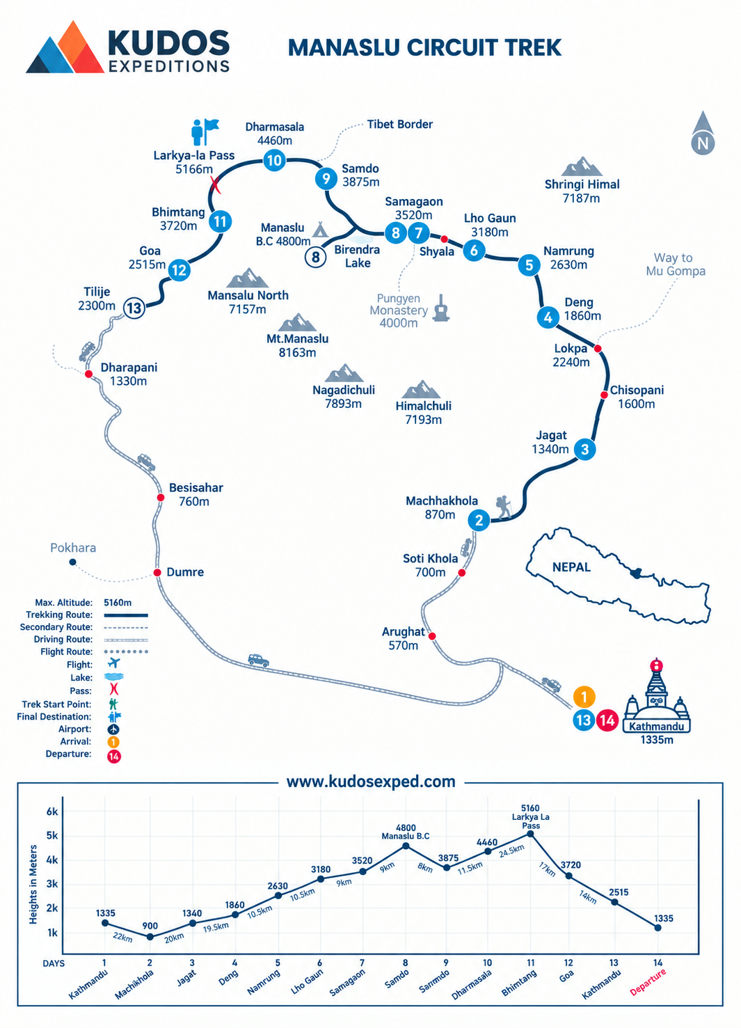
Manaslu Circuit Trek Trek MAP
Join fixed Departure with Ang
Departing Dates
and Price
Availability
9 April, 2027 - 11 April, 2041
$ 1550
1
17 May, 2026 - 30 May, 2026
$ 1550
1
1 October, 2026 - 15 October, 2026
$ 1550
1
Must Know Before your Trip
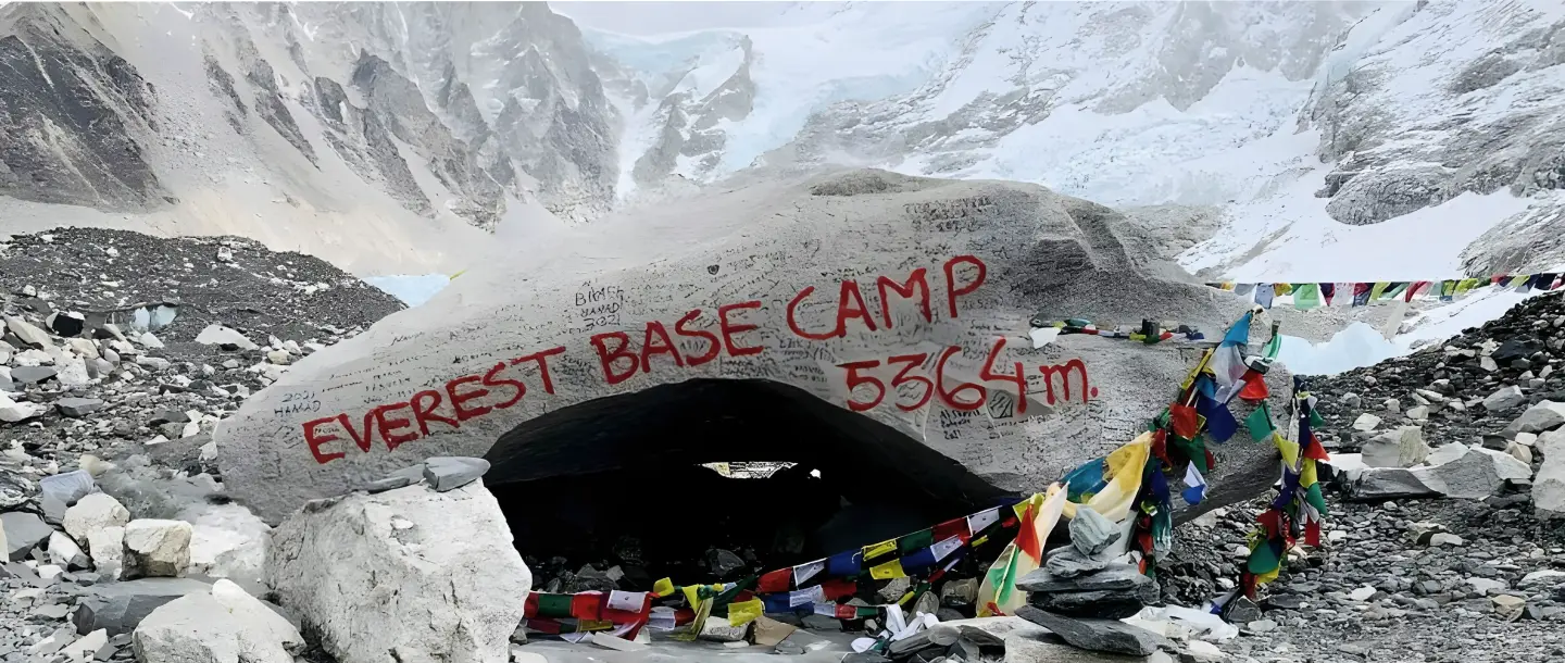
Everest Base Camp Trek: The Complete 2026 Planning Guide
Why Every High-Altitude Trekker Needs These Two Life-Saving Tools (And How to Use Them Properly)
Acclimatiation Process to make your trip successful

Why Trekkers Fail to Reach the Final Point in Nepal
Nepal Visa Information 2025: Complete Guide for Trekkers & Travelers
Gears for Nepal
Learn More